San Jose 101 & 280 Interchange downhole array

This site is located at the 101/280 freeway interchange in San Jose at  37.3393, -121.8520 (approx 31m elevation). A single Granite unit records a surface Episensor and three downhole Hyposensors at 17, 42 and 91m. UCSB assisted in the downhole installations on 3/2/16. The deep hyposensor had a compass and was glass beaded in at 347.2o magnetic, within 1 degree of true-North, and the other two hyposensors were installed with loading-poles, rotated and aligned to true-North.

Glen Alps 'rock' site

About 17km south-east of downtown at an elevation of 716m, thats at the edge of the Anchorage lowland alluvial plain, at the base of the Chugach Mountains, a surface and downhole (30ft depth) accelerometer are installed in rock.

Atwood Building, Anchorage

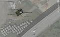
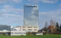
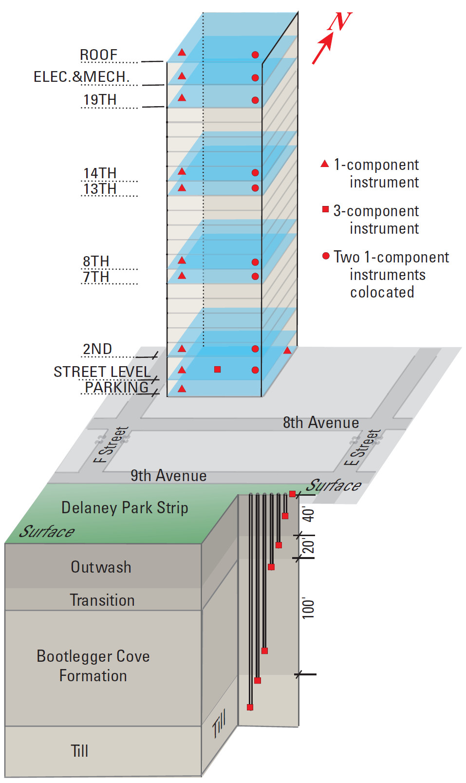
The Atwood building is instrumented from the basement to the roof with a total of 32 accelerometer sensors. The building is located just two blocks north of the Delaney Park downhole array. Together the form a richly instrumented system that records local ground motions and building response.

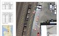
The complete instrumentation details are illustrated by this diagram (courtesy of the USGS).

For more information see the USGS fact sheet:

Çelebi, M., McCarthy, J., Biswas, N., Wald, L., Page, R., and Steidl, J., 2004, Seismic Monitoring of the Atwood building in Anchorage, Alaska: U.S. Geological Survey Fact Sheet 2004-3103

http://pubs.usgs.gov/fs/2004/3103/

Build motion visualizations for real events

This video https://www.youtube.com/watch?v=Nt0m5JWa62w  presents a visualization of how the Atwood Building in Anchorage, Alaska, shook during the M7.1 January 24, 2016, Iniskin, Alaska, earthquake. The building was instrumented by U.S. Geological Survey to obtain data to study its behavior and performance during strong shaking. Such data is useful to make decisions for improving the building's performance. The video of the building exhibits, translational, torsional motions, as well as beating effects.
Note that the visualization is magnified by a factor of 300 to show its deformation characteristics. Produced by: Mehmet Celebi (USGS), Mark Bonito (USGS)

This video https://www.youtube.com/watch?v=9MlvLdnwLY4 presents a visualization of how the Atwood Building in Anchorage, Alaska, shook during the Mw 7.0 November 30, 2018, Anchorage, Alaska, earthquake. The building was instrumented by the U.S. Geological Survey to obtain data to study its behavior and performance during strong shaking. Such data are useful in making decisions about improving the performance of the building.  Translational (back-and-forth) motion (more dominant in the East-designated direction) and limited torsional (twisting) motions are both observed, as well as limited beating effects (alternating cycles of generally increasing and decreasing levels of motion that occur when the structural damping of a building is low and when frequencies of translational and torsional motions are close).
Note that relative to the height of the building, the motions are magnified by a factor of 100 to show how the building deforms.

Delaney Park Alaska Digital Array

The Delaney Park Array, with its six 3-component accelerometers at depths from the surface down through the near-surface soil column to 61m, is situated in downtown Anchorage, Alaska. Anchorage sits on top of the great Alaskan subduction zone and has been subjected to large damaging earthquakes in the past. The March 27th, 1964 (Good Friday), magnitude 9.2 great Alaska earthquake shook the ground for more than 4 minutes over a 50,000-square-mile region and caused 131 deaths.

The Delaney Park Array was deployed in September 2004 to provide the input ground motions to the nearby instrumented 'Atwood' building during an earthquake, in order to better understand the combined response of the soil and the structure.

The Atwood building (20 stories, 81m tall) is one of the first buildings to be fully instrumented under the Advanced National Seismic System (ANSS) effort, a Federal Government funded program to improve ground and structural recording of earthquake-induced shaking in high-risk urban areas. ANSS projects like this will provide engineers with critical answers as to how particular building types respond to strong ground shaking.

Hollister Digital Array

Agbabian Associates installed the Hollister Earthquake Observatory (HEO) in 1991 with funding from the Kajima Engineering and Construction Corp. Kajima Corp donated this array to the University of California, Santa Barbara in January 1998. The site is located in the Salinas Valley about 10 kilometers from the San Andreas fault near the cities of Hollister and Salinas in central California. The ground motion array consists of a vertical array of six accelerometers in Quaternary alluvium and bedrock, and three accelerometers installed at a remote rock station, 3 km to the Northeast. The location of HEO along the San Andreas Fault in Central/Northern California increases our chances of recording a moderate to large earthquake.
 

Borrego Valley Field Site

In 1993, Kajima Engineering and Construction Corp. and Agbabian Associates established the Borrego Valley Downhole Array (BVDA) near Borrego Springs, in Southern California. The BVDA site consists of borehole and surface instruments that extend east-west 3000m across the Borrego Valley and a remote rock site at the western edge of the valley that includes surface and borehole sensors. The site was installed to provide information about wave propagation across the alluvial basin generated by the Coyote Creek and Clark Faults.

PG&E


​The UCSB Geotechnical Array monitoring program is jointly funded by the Department of Energy (award #DE-SC0020291) and a gift from Pacific Gas & Electric Co. 

This site previously funded 2015 to 2017 by the NRC Contract#NRC-HQ-60-15-C-000, project title "Observations and Analysis of Geotechnical Data". And 2004 to 2014 by the Geoge E. Brown, Jr. Network for Earthquake Engineering Simulation (NEES) Program of the National Earthquake Hazards Reduction Program (NEHRP) of the National Science Foundation (NSF) under Award# CMMI-0927178. With additional funding from USGS.